Showing posts with label monitoring. Show all posts

02 July, 2019

State of the Climate 2018

The Bureau of Meteorology and CSIRO play an important role in monitoring, analysing and communicating observed changes in Australia's climate.
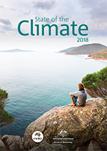
State of the Climate 2018 report cover
This fifth, biennial State of the Climate report draws on the latest monitoring, science and projection information to describe variability and changes in Australia’s climate. Observations and climate modelling paint a consistent picture of ongoing, long term climate change interacting with underlying natural variability.
These changes affect many Australians, particularly the changes associated with increases in the frequency or intensity of heat events, fire weather and drought. Australia will need to plan for and adapt to some level of climate change. This report is a synthesis of the science informing our understanding of climate in Australia and includes new information about Australia’s climate of the past, present and future. The science underpinning this report will help inform a range of economic, environmental and social decision-making and local vulnerability assessments, by government, industry and communities.

Read and download the full report - “State of the Climate 2018.”

07 May, 2018

Earth’s atmosphere just crossed another troubling climate change threshold

For the first time since humans have been monitoring, atmospheric concentrations of carbon dioxide have exceeded 410 parts per million averaged across an entire month, a threshold that pushes the planet ever closer to warming beyond levels that scientists and the international community have deemed “safe.”
Recent CO2 measurements at Mauna Loa Observatory in Hawaii.
The reading from the Mauna Loa Observatory in Hawaii finds that concentrations of the climate-warming gas averaged above 410 parts per million throughout April. The first time readings crossed 410 at all occurred on April 18, 2017, or just about a year ago.

Carbon dioxide concentrations — whose “greenhouse gas effect” traps heat and drives climate change — were around 280 parts per million circa 1880, at the dawn of the industrial revolution. They’re now 46 percent higher.


Read the story by Chris Mooney from The Washington Post - “Earth’s atmosphere just crossed another troubling climate change threshold.”

13 October, 2017

Satellites are giving us a commanding view of Earth’s carbon cycle

The job of monitoring Earth’s carbon cycle and humanity’s carbon dioxide emissions is increasingly supported from above, thanks to the terabytes of data pouring down to Earth from satellites.

Carbon dioxide flux over China, measured by
NASA’s Orbiting Carbon Observatory-2 satellite.
Five papers published in Science today provide data from NASA’s Orbiting Carbon Observatory-2 (OCO-2) mission. They show Earth’s carbon cycle in unprecedented detail, including the effects of fires in Southeast Asia, the growth rates of Amazonian forests, and the record-breaking rise in atmospheric carbon dioxide during the 2015-16 El NiƱo.

Another satellite study released two weeks ago revealed rapid biomass loss across the tropics, showing that we have been overlooking the largest sources of terrestrial carbon emissions. While we may worry about land clearing, twice as much biomass is being lost from tropical forests through degradation processes such as harvesting.

The next step in our understanding of Earth’s carbon dynamics will be to build sensors, satellites and computer models that can distinguish human activity from natural processes.

21 August, 2017

'Concerning': Sydney's water catchment faces rising loss to mining, contaminants

Coal mining in Sydney's catchment is having a "cumulative and possibly accelerated" impact on water flows but its full effect is unknown because of a lack of monitoring.

Sydney's main reservoir, Warragamba Dam, was
among areas with the poorest results in the water audit
These are among the findings of the 2016 Audit of the Sydney Water Drinking Catchment, a study required by law every three years, that the Berejiklian government quietly tabled in parliament this month. Just a single copy of the report was available to borrow. 

The audit, which covers the 16,000-square-kilometre catchment that stretches from Lithgow in the Blue Mountains to near Cooma and stores as much as 2.6 million megalitres of water, found "reduced water availability" compared with the 2013 report.

It found mixed trends, with parts of the catchment improving but others worsening. Lake Burragorang – Sydney's main reservoir sitting behind Warragamba Dam – was among areas with the poorest results for surface flows.


Read Peter Hannam’s story in The Sydney Morning Herald - “'Concerning': Sydney's water catchment faces rising loss to mining, contaminants.”

26 May, 2017

The plan to protect wildlife displaced by the Hume Highway has failed

It’s no secret that human development frequently comes at a cost to other creatures. As our urban footprint expands, native habitat contracts. To compensate for this, most Australian governments require developers to invest in biodiversity offsetting, where habitat is created or protected elsewhere to counterbalance the impact of construction.
Hundreds of large old trees were removed when the Hume Highway was widened
Although biodiversity offsetting is frequently used in Australia – and is becoming increasingly popular around the world – we rarely know whether offsets are actually effective.

That’s why we spent four years monitoring the program designed to offset the environmental losses caused by widening the Hume Highway between Holbrook and Coolac, New South Wales. Our research has found it was completely ineffective.